


Outcrop app for iPhone and iPad
Developer: Next-Shot
First release : 08 Mar 2016
App size: 19.25 Mb
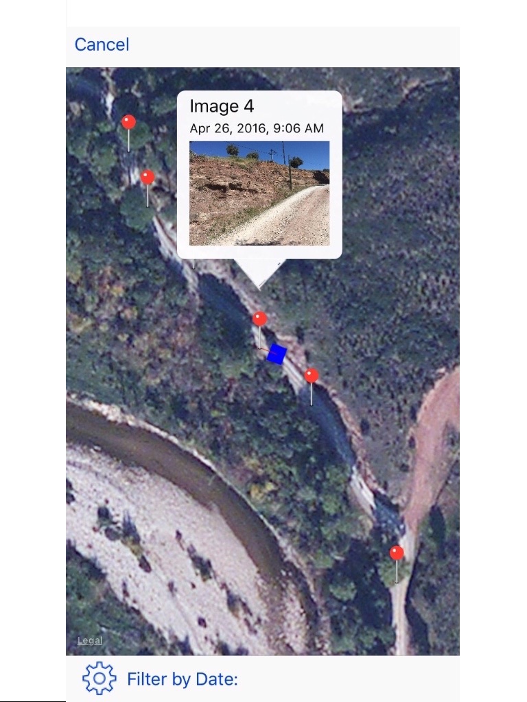
This application is designed for the geologist to use during field studies. It lets the user take pictures of the outcrop, interpret the high resolution image and export this information in 3D to construct a 3D geological model.
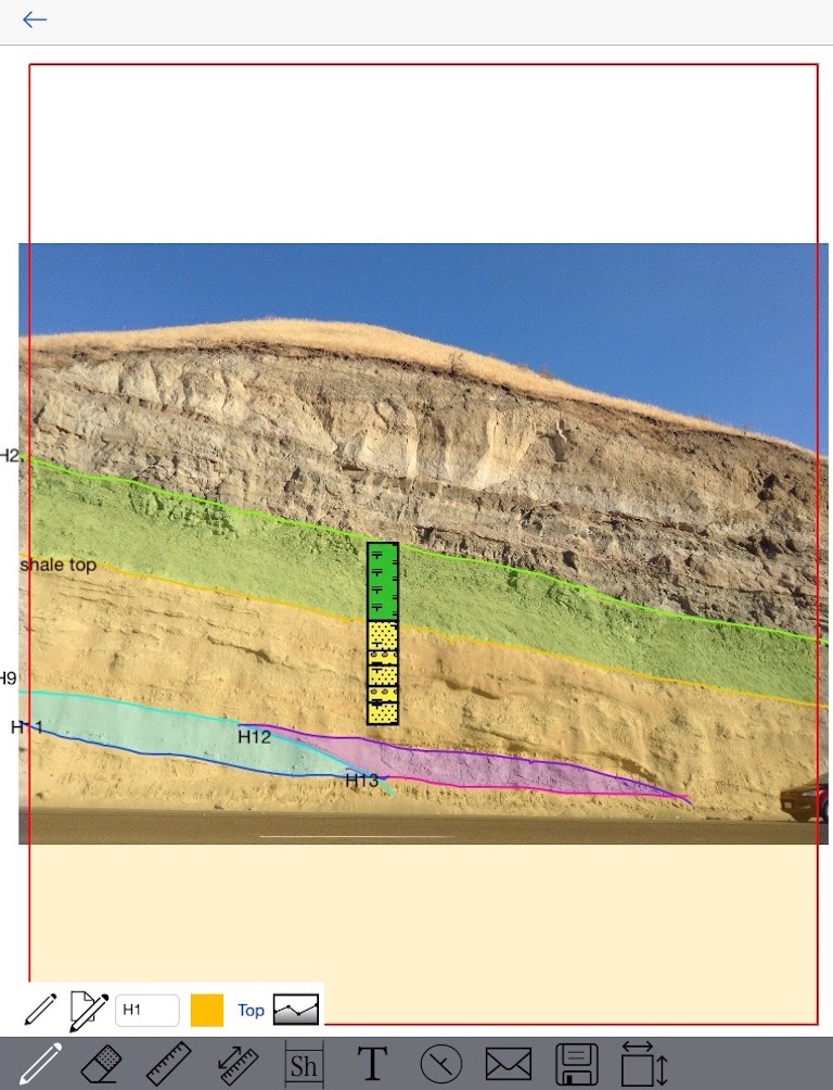
On the image, the user can interpret facies intervals, sedimentary structures and boundaries. The user can add annotations anywhere, measure width/height of sediment bodies (channels, lobes, etc.), and compute bodies statistics.
Using an iphone or ipad, the user can measure dip and azimuth and locate this measure on the picture or use its GPS location to export dip markers to the 3D model.
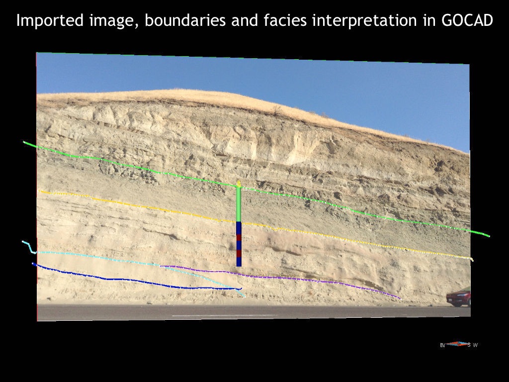
Once the user defines the image scale, all interpreted boundaries and intervals can be exported in 3D in GOCAD format (image, interpretations boundaries, dip/azimuth and facies intervals).